//ads start// //ads end// ಸುತ್ತೋಣ ಬನ್ನಿ - Sutthona Banni: May 2009

///ad links google adsence


This place is situated in Uttara Kannada District.16 Kms from Bhatkal on the Bhatkal shimoga SH, Theerthankara Bastil at Haduvalli is a 14th century Jain temple. 24 Theerthankara idols are installed there. The place was formerly capital of the queen Channabyra Devi. There are two hills Chandragiri and Indragiri which attract the tourists for scenic beauty


Photo Gallery:


Courtesy: Wikipedia

This place is situated in Uttara Kannada District.The Island of Basavaraja Durga is about a km from main land off Honnavar. You can reach the island through boats and small coasters. The landing place is at the south end where there is a ruined fort with eight mounted guns. The fort was built by Great Shivappa Naik of Bednur (1648-1670). The island is mostly level and has plenty of fresh water.

Courtesy: Wikipedia


This place is situated in Uttara Kannada District.Higund is a beautiful island in River Sharavati just before it joins the Arabian Sea. 3 kms from Honnavar – Bangalore National Highway brings you along this island. Presently the approach is from either Adkar village or Kodani village through country boat. The sunset view from this island is a lifetime experience.

Courtesy: Wikipedia


This place is situated in Uttara Kannada District.Newly constructed Gerusoppa dam has created a unique reservoir in gerusoppa valley. The breath taking view of the valley can be had from atop a observation tower constructed by Forest dept, about 10 kms from Gerusoppa towards Jogfalls. Boat cruise in the reservoir through the valley is on the anvil.

Courtesy: Wikipedia


This place is situatedin Uttara Kannada District.Situated on bank of river Sharavati the old town of Gerusoppa also called NAGAR BASTIKERI is rich with historical monuments, the Chaturmukha basti being the most prominent one. It is a beautiful structure built in Vijayanagar style with Chaturasara plan. It has four entrances from four directions leading to garbhagrihas. There are four images of Tirthankaras, Vrishabha, Ajita, Sambhava and Abhinandan, seated in padmasana. One of this has been of late damaged. The engravings in this basti of dwarapalas and other mural desigtns are well executed with refinement.

Courtesy: Wikipedia


This place is situated in Uttara Kannada District.Right at the foot of Western Ghats, Kadra is little of gem nature’s beauty. It became famous due to the dam across Kali river and its powerhouse. A beautiful park with fountains, cascades, caves, colourful trees and plants, rose garden, and a unique vedic garden depicting sun signs, planets, rain stars is coming up. Water sports is also being planned in the reservoir.

Mahamayi temple near Kadra is an ancient and very popular temple, which is visited by people from afar. The temple is situated in side the forest and has blissful atmosphere

Nearby places to visit:Anashi sanctuary(10Kms), Ulavi (36 Kms), Kadra falls (5 kms on the SH)

Connectivity: 33 Kms from Karwar (Road NH) 168 Kms from Hubli (Road NH)

Courtesy: Wikipedia


This place is situated in Uttara Kannada District.Chandavar once a big city, is said to have been built by a Muslim King Sarpan Malik (apparently Sherif-ul-Mulk a General of Bijapur Kingdom). The city declined during the later part of 17th century. St. Francis Xavier Church is a large Roman Catholic Church is held in great veneration by local populace of all communities. The original church of St. Francis Xavier is recorded to have been built in 1678 during the reign of Basappa Nayak of Keladi Nayak dynasty. The church was destroyed in the end of 18th century which is attributed to Tippu Sultan, and was rebuilt in 1801. The church was rebuilt a second time in 1874. The old church, though an imposing edifice was judged to be beyond normal repairs, and so a new church was built in the area adjacent to the old church.

Courtesy: Wikipedia


This place is situated in Uttara Kannada District.Dhareswar is about 8 kms south east of Kumta. On the hill slope is Mahadev temple, said to be around 800 years old. There are four inscribed tablets in the temple. It appears that the construction of temple was started by Rudroji Pandit and completed by Sonappa somewhere between 1500 and 1559. The temple is built of black stone and its walls are ornamented with sculptures. Round the temple are 5 holy pools, Rudra kund, Chakra, Shankh, Vasudha and Nagatirth. A fair is held every year in the middle of January

Courtesy: Wikipedia


This place is situated in Uttara Kannada District.Almost touching the Kumta town, towards south is Alvekodi village. One has to go through the fields to reach the beach. The beach is truly pristine, unspoilt. The white sand dazzles in the sun. Nearby is the Bhrahma devara gudda, with dilapidated old lighthouse. The hillock is a great picnic spot offering memorable sunset view

Courtesy: Wikipedia


This place is situated in Uttara Kannada District.Moving towards Mangalore from Karwar on the National Highway, you have to take a deviation after 22 kms and proceed 4 kms to reach Belekeri Beach. You will not regret the detour. The vast grass lawn suddenly drops by 50’ to the beach providing a wonderful view of the sea. The land is surrounded by picturesque mountains. Watching sunset in the evening you would never like to leave the place

Nearby places to visit:Katyayani Temple, Aversa (10Kms)

Courtesy: Wikipedia

This place is situated in Uttara Kannada District.About 8 kms north of Ankola, 25 Kms from Karwar, Aversa has a famous Katyayani Temple. The distinct feature of this temple is that the shrine is in the shape of a ship. It is family godess of Kharvis, a fishermen clan. The image of godess is said to have been found in the sea. The godess is worshipped with great solemnity during the nine nights of ‘Navarathri’ which precede ‘Dussera’ in October. Besides Kharvis the festival is solemnly attended by many dancing-girls and Konkanis.

Courtesy
: Wikipedia


This place is situated in Uttara Kannada District.6 Kms from Karwar, located at 1800 feet above sea level, the peak gives a panoramic view of the Karwar and the sea. Extremely cool round the year, it was a summer resort for the British.

It is one of the highest peaks of Haiderghat range which stretches east and west between Kali river and Belikeri river and joins the Kaiga range at Kaiga. Guddehalli raises conspicuous for miles, an abrup sheet of granite with thickly wooded sides and a bare tapering point. A five kilometre trekking through mountain jungle crossing brooks and springs, takes you to this spot. The trek itself is a bonanza of enthralling experience.

Courtesy: Wikipedia


This place is situated in Uttara Kannada District.
4 Kms from Karwar shore is the Kurumgad island. There is Narasimha temple atop the hill in the island where an annual fair takes place. Scores of boats ply to the island on that day. The island is a private island. The owner is running a resort called The Great Outdoors in the island. It is a wonderful picnic spot and could get experience of a lifetime if one could stay

Courtesy: Internet

This place is situated in Uttara Kannada district. 4 Kms from Karwar, Shejwad boasts of a thousaqnd year old ancient temple of Shejjeswar or Siddeswar. The temple is said to be one of the five temples of Gokarna mythology where pieces of Atmalinga which Ravan was carrying, fell; the other four being Gokarn, Murudeswar, Dhareswar and Gunavanteswar. Devotees visit the temple in thousands on Mahashivaratri day

Courtesy: Wikipedia


This fort is in the Mirjan village on NH-17, 10 km from Kumta in Uttara Kannada District.
The Fort at Mirjan was constructed during A.D 1608-1640. Excavation conducted at the site during the field season 2000-01 has unearthed a number of laterite structures of medieval period . The structural remains include a U shaped structure with a cloister all around. Towards the west of the U shaped structures, a circular soakage pit constructed of dressed laterite stones and water tank connected with water carrier were exposed. Among the antiquities mention may be made of a unique gold coin issued in A.D. 1652 by the Portuguese Viceroy Conde De Sarzedas during the rule of JOAO IV. The other antiquities include canon balls, Chinese Porcelain, clay tablets with Islamic inscriptions.
Many of Kannada films like Dunia, Galipata was shooted here.

Photo Gallery:


Photo Courtesy: Wikipedia

- Sadashivagad is situated in Uttara Kannada District, 6 Kms from Karwar on the northern bank of River Kali. Crossing the magnificent Kali bridge you reach Sadashivagad, a place of historical importance. There are ruins of old fort of Sonda kings. Midway on the Sadashivagad hill is the 600 yrs old Shantadurga Temple, known for its serenity. From the peak of the hill, the view of the sun setting in the Arabian sea, is an experience in itself. There is also a 17th century Darga which attracts a lot of Muslim pilgrims. A Yatri nivas is being built on top of the hill by Dept. of Tourism

Nearby places to visit: Devbag (4Kms), Karwar (6 Kms NH)

Connectivity: 110 Kms from Panjim. 168 Kms from Hubli (Road NH) 270 Kms from Mangalore ( Train & Road NH)

Photo Gallery:


Godess Shanthadurga


Photo Courtesy: Wikipedia


Karikanamma Hill is a tourist spot located near Honnavar town of Uttara Kannada district (Karnataka). This place is around 12kms from Honnavar town. Here you can see the Goddess Sri Karikana Parameshwari temple. On  the top of hill you can view beautiful scenery. In that hill “Vandadke” (Ondadike or Ondadke) a devotee place is there. You have to walk in forest around 1km to see “Vandadke” from Karikanamma Temple.

Route Map:

From Honnavar town, go in Honnavar-Kumata National Highway (NH-17) after 0.5km you will get Are-Angadi cross on right side. Take diversion on right side and go in Are-Angadi road around 6kms you will get Are-Angadi. From Are-Angadi you have to go around 6kms & then you will get Karikanamma Hill. On the way to Are-Angadi you will get Ramateertha (2.5kms from Honnavar) which is a tourist spot.

Photo Gallery:


Photos: Shriharsha.B.S., Sri Sankara TV & Wikipedia 
Information: Shriharsha.B.S. 


Anshi National Park is located in Uttara Kannada district, in the Indian state of Karnataka, bordering the state of Goa. The 340 square kilometre park adjoins the Dandeli wildlife sanctuary, and together with six other protected areas in the states of Goa and Maharashtra, forms a protected forest area of over 2200 square kilometres.

The park is a habitat of melanistic leopards, tigers and elephants, amongst other fauna.


History

The forest in the area was declared the Dandeli wildlife sanctuary on 10 May 1956. The state proposed carving out a section of the sanctuary to form the Anshi national park, and the proposal was implemented on 2 September 1987. The initial proposal covered 250 square kilometres. When the final notification of the park area was issued in 2002, it was extended by another 90 square kilometres.

Anshi and Dandeli were granted the status of Project Tiger sanctuaries in January 2007.

Geography

Located in the Western Ghats range, Anshi's altitude varies from 200 m to 925 m above sea level. The park is situated in the North Western Ghats montane rain forests and North Western Ghats moist deciduous forests ecoregions, both of which are deemed endangered by the World Wildlife Fund[3].

Park management

The management of National parks and sanctuaries in the state is the responsibility of the Principal Chief Conservator of Forests (Wild life). Anshi National Park and the adjoining Dandeli wildlife sanctuary together form the Dandeli Wildlife Division of the Karnataka Forest Department, headed by a Deputy Conservator of Forests.

Flora

The forests in the area are rich in flora and fauna. Trees and plants that can be found here include Bamboo, Bauhinia, Eucalyptus, Lantana, Silver Oak, Teak and Xylia xylocarpa.

Fauna

A variety of Bonnet Macaque, deer (barking, mouse and spotted), Indian bison, Malabar Civet, Malabar giant squirrel, pangolin and sloth bear make their home in the forests of the park. Besides, the black panther, elephants and tigers are rare species found in the park.

Reptiles spotted in the park include the King Cobra, Krait, Python, Rat snake and Viper.

Around 200 species of birds are recorded in the park. These include the Adjutant Stork, Ashy Woodswallow, Black-crested Bulbul, Blue-headed Pitta, Brahminy Kite, Broad-billed Roller, Crested Serpent Eagle, Great Hornbill, Golden-backed Woodpecker, Malabar Pied Hornbill, Sri Lanka Frogmouth and Yellow-footed Green Pigeon.

Best Time To Visit: November to June.

Nearest Town: Dandeli(37.5 kms)

Route:
Air: Nearest airport is Goa
Rail: Nearest Railway station is Karwar (60 kms), Londa (100kms) or Dharwad 106 Kms
Road: There are regular buses from Dandeli to Bangalore (523 km), Panaji (150km), Dharwad (106kms), Belgaum (150kms), Karwar(60kms) pune and Mumbai. From Bangalore it is 580 Kms to Anshi National Park.

Photo Gallery:


Courtesy: Wikipedia


Dudhsagar Falls (दुधसागर धबधबा in Marathi; ದೂದಸಾಗರ್ ಜಲಪಾತ in Kannada; English translation: Sea of Milk ) is a tiered waterfall located on the Mandovi River in the state of Goa, India, on Goa's border with the state of Karnataka. It is 60 km from Panaji.

Legend

Legend has it that a beautiful princess lived in the forest (near present day, Dudhsagar Falls) where there was then a palace. She loved and enjoyed bathing in a lake nearby and used to drink "sweetened milk" from her "Golden Jug" after finishing with her bath. One day while enjoying her jug of milk she found herself being watched by a prince, who was standing amongst the trees. Red with embarrassment at her inadequate bathing attire, she poured the jug of milk in front of him to form an improvised curtain to hide her body, while the maids rushed to cover her with her dress.
And it is said that, it is that sweetened milk that cascades down the mountain slope to this day as tribute to the virtue and modesty of the Princess, as the "Dudhsagar Falls".

Location and surounding


The falls is in the border of Karnataka and Goa and the roads leading to it are maintained by the Goa Forest Department, and are closed in the rainy season. The roads are again opened from the month of October. At its base, there is a small pond. One can bath but in their own risk. There are also fishes in the pond and the water is very cold, even in the afternoon. The Waterfall is located inside the Bhagwan Mahavir Wild Life Sanctuary at Collem in South Goa along the western Ghats.
The surrounding area is surrounded by a deciduous forest and there are many species of birds, insects, plants and animal abound here.

The waterfall

Dudhsagar is one of the world's most exquisite falls that lies in India.The falls lie high up in the Mandovi River's watershed and so are not particularly spectacular during the dry season. During the monsoon season however, the falls are transformed into one of the most powerful falls in India.
Dudhsagar Falls is listed as India's 5th tallest waterfall,and is 227th in the world at 310 m.The water plummets hundreds of feet in large volumes during the monsoon season, forming one of the most spectacular natural phenomena in Goa. It is a major part of the Goa ecosystem.This is a four tiered waterfall with a total height of 310 metres (1017 feet) and an average width of 30 metres (100 feet).

Transport

The Water Fall can be reached both by road and rail. It can be reached by road from the National Highway (NH-4A). The nearest Station to the falls is Collem (Kuhlem) (South Central Railway). The route for rail to reach the falls from Goa is Collem - Mollem (6 km) - Dudhsagar Falls. The another route is from Carambolim (Karmali Railway Station - Konkan Railways). The route is Carambolim - Old Goa - Ponda - Tiska- Mollem (total 50 km) - Dudhsagar Falls.
But entering the park and mountains which lead to the falls is not advisable in a normal car, and may only be accessible to SUV's and 4WD jeeps, as the road comprises a jungle track that has rivers criss crossing it at several points. The driver drops one just near the falls from where one may have to walk 1 kilometre ahead, crossing over small ways carved through the rocks at the foot of the falls. This waterfalls lies on the Londa-Margaon railway route.
The falls is in the border of Karnataka and Goa and the roads are maintained by the Goa Forest Department, and are closed in the rainy season. The roads are again opened from the month of October. The train route to reach the falls from Karnataka is as follows:

Trekking

Trekking in Dudhsagar is a famous tourist attraction. There are 2 abandoned shelters for the refuge of trekkers (left to the falls and right side beside the railway track) however they are available on the first come first serve basis. Medical and pure drinking water facilities are not available around Dudhsagar but one can approch the station guard at Dudhsagar railway station in emergency. There are 4 possible routes to reach Dudhsagar Falls, of which only two are accessible in monsoon.
Route 1 (Castle Rock Route)
This is the most famous route during the monsoon, Reach Castle Rock station and start a Scenic 14 km hike to Dudhsagar Water falls along the railway track, it normally takes 5–6 hours for a normal person to reach.In this route we will be passing through a number of tunnels, a board reading "Welcome to Goa" and also great views of the Valley.
Route 2 (Kulem Route)
This is equally scenic but less popular as compared to Route 1, One has to get down at Kuhlem/Collem Railway station and walk towards the falls which is about 11 km away. It normally takes 4–5 hours for a normal person to reach. The famous photograph of Trains passing through before the waterfalls can be seen in this route, and also the complete strecth of the falls will be visible while you hike towards the waterfalls.
Route 3 (Transport + Hike)
In Kulhem one can hire a 4X4 to reach the foot of the Dudhsagar waterfalls, There is a taxi stand called 'Dudhsagar Taxi stand' where one can hire a vehicle and get dropped near the falls which is 1 km hike from the dropping point. This is used in the post-pre monsoon season and is suitable for large groups with kids and ladies.
Route 4 (Kuveshi-Dudhsagar)
This is the most adventurous route and cannot be attempted in monsoon since we have to cross Mondovi river during the hike. The hike starts from a village called Kuveshi around 10 km from Castle Rock railway station. The hike is through thick jungle and is difficult to complete without experience. By this we can reach Dudhsagar Railway station which is 1 km from the falls.

 Photo Gallery:


Courtesy: Wikipedia


Doeguling Tibetan Settlement
This place is situated in Uttara Kannada District.The Gaden Jangtse Monastic University for Advanced Budhist Learning & Practice which had become near extinct Tibet, was rebuilt on the Indian soil at Doeguling Tibetan Settlement, Mundgod. The construction of New Monastic University building started on June 1998 and was inaugurated on 19 Dec 2001. This majestic building is the biggest monastery in Asia. Inside the prayer hall is a 21’ tall statute of Lord Buddha. Besides this there are statues of Green Tara (10’), Maitrieya Buddha (15’), Manjushri Buddha (15’) and Chenrezig statue

Photo Gallery:


Courtesy: Wikipedia


Attiveri Bird Sanctuary

It is situated in Uttara Kannada District. 19 Kms from Mundgod one has to take a diversion on Mundgod – Hublic road to reach Attiveri. Migratory birds from Central Asia, Northern Africa and European countries find serene Attiveri a congenial place to breeding from October to March. Painted Storks are special attraction. Sun set view is an extravagant bonus

Nearby places to visit: Mundgod Tibetan colony.

Connectivity: 50 Kms from Hubli. 250 Kms from Dabolim Airport Goa.


Courtesy: Wikipedia


Sintheri Rocks

This place is situated in Uttara Kannada District, 20 Kms from Joida , at Sintheri Temple, River Kateri flows with great speed before joining River Kali. Currents of water have formed beautiful rock caves and have created small cascades in the valley attracting a great number of tourists. 

This place is comes in Dandeli-Joida route

Sintheri rock which is 400 feet in height and 600 feet in width. Water flows around this sand stone round the year

Nearby places to visit: Ulavi temple. Kavala caves. Supa Dam at Ganeshgudi.

Connectivity: 20 Kms from Dandeli. 120 Kms from Karwar.

 
Photo Gallery:


Courtesy: Wikipedia

Sykes Point, Ambikanagar.

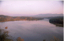
Sykes Point, named after British Collector Sykes, is a breathtaking spot where one can seek unhindered view of the Kali River flowing through the valley below. Nagajhari Power house situated at the bottom of this peak can also be seen

Nearby places to visit: Bommanahalli Pickup dam. Supa dam, Ganeshgudi.


Connectivity: 20 Kms from Dandeli.

Photo Gallery:


Courtesy: Wikipedia


Ulavi is a town about 75 km from Karwar (via Kumbarawada) in Karnataka state, Uttara Kannada District.

Ulavi is an important center of pilgrimage for people of the Lingayat faith. The Samadhi of Channabasavanna, one of the most revered saints of the Lingayat faith lies here. In the 12th century, Channabasavanna traveled from Kalyana to Ulavi before he died. Very close to this holy Samadhi is the Akka Nagalambike cave named after Nagalambike, Channabasavanna's mother and Basavanna's sister. The Ulavi jathre or congregations attracts pilgrims from all over Karnataka as one of the major community or `panchamsali linjayaths' are large number devoted here visiting regularly.

Ulavi is located at western ghatts. Thick forests here hold tiger, chita, elephent, sarang, cobra, lots of wild life.

Nearest places: Dandali, Dharwad, Hubli.

Transport: better to travel in one's own vehicle. Three daily buses traveling via Dharwad from Hubli, Chitradurga, Haveri and Belgum.

Other atractive placess: cintherei Rock, Kali River, Anashi Reserve Forest, Supa Dam.

Photo Gallery:


Courtesy: Wikipedia
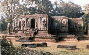

Dandeli is a city in Uttara Kannada District of Karnataka, India in the Western Ghats, near to Goa. It is best known for its wildlife sanctuary, tourism, industry and as an educational hub.

A significant part of Dandeli's population consists of economic migrants from all over India and from Nepal. Although the official language is Kannada, there are significant minorities who speak Hindi, Konkani, Marathi, Gujarathi,Telugu, Tamil and Malayalam.The diversity of its population is reflected in its culture, and the Dussera, Ramleela, Ganesh Chaturthi and Diwali festivals are all celebrated.


Name

The origin of the name of the city is unknown. However, local legend states that the city is named after Dandelappa, a servant of the Mirashi landlords who lost his life because of his loyalty. An alternative legend states that a king named Dandakanayaka passed through the forests and named them after himself, and the city is believed to stand on the place where Dandakaranya stood.

Wildlife sanctuary

Dandeli is a natural habitat for wildlife including tigers, leopards, black panthers, elephants, gaur, deer, antelopes, and bears. It has recently been designated as a Tiger reserve. The jungle is also home to many kinds of reptiles and around 200 varieties of birds. The rapid expansion of tourism and industry has raised fears of ecological damage and local voluntary groups have formed to address the issue.


Tourism

Dandeli, surrounded by thick jungle with River Kali dashing through furiously, is a nature lover’s paradise. Jungle Lodges Resorts has a fine tourist complex called ‘Kali Wilderness and Adventure Camp’. This is the only place in South India where tourists are offered white water rafting.
The Bison River resort on the banks of River Kali near Ganeshgudi is another place of sojourn for the tourists. The resort offers facilities to carry the tourists to see wildlife at Phanasoli, Kavala caves etc. It also offers river rafting facilities along with JLR at Dandeli.

Landmarks

Dandeli is surrounded by natural, historic and religious landmarks. The river Kali, the caves of Kavla, the Syntheri rocks, and other landmarks including the Ulvi temple, Sykes point and the Supa hydroelectric dam.

Transport links

Dandeli is well connected by road to nearby cities. It lies 55 km from Dharwad, 72 km from Hubli and 95 km from Belgaum. Buses run by the KSRTC run to Dandeli daily from nearby cities. The nearest airports are at Hubli, Belgaum and Goa. Its British-built railway was the first in North Kanara, but it is no longer operational for the public. The nearest passenger rail stations are at Alnavar, Londa, Dharwad and Hubli.

Photo Gallery:

White Water Rafting

Rafting

Courtesy: Wikipedia